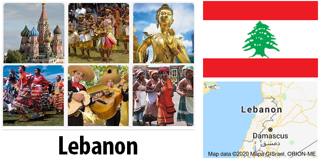
The Republic of Lebanon is a relatively small country in the Middle East. It has a long coastline to the Mediterranean in the west and a long state border with Syria in the east. In the south, Lebanon shares a border with Israel.
In addition to impressive landscapes, the Mediterranean country offers numerous archaeological sites and historical monuments.
The capital Beirut is one of the most tolerant and cosmopolitan cities in the Middle East. The vibrant city attracts with a variety of attractions. One is the National Museum, which documents everything from Phoenician art to relics from the civil war period. Also worth seeing is the neoclassical Maronite Cathedral of St. George, which serves as a church for an old and unique Lebanese Christian community. One of the oldest mosques in Lebanon is the Amir Munzir Mosque. Roman columns can be seen in its courtyard. A visit to the ancient Roman baths and a pedestrian crossing known as the Corniche along the coast gives an impression of a long past.
Lebanon is a diverse country and also very interesting in terms of architecture. Anyone who travels here will find breathtaking buildings in the Renaissance style, which is probably not expected here. Even a strong Italian influence cannot be denied in the architecture of numerous buildings.
The country also owes its beautiful buildings to the former ruler Fakhr-al-Din II, who campaigned for the development of Lebanon in the 17th century. Fakhr-al-Din was brought to Tuscany by the Ottomans at the beginning of the 17th century exiled. There he allied himself with the Medici and returned to Lebanon 5 years later. When he returned to Lebanon, he immediately began implementing his plans to modernize Lebanon. Thanks to him, various industries emerged, such as the production of silk and olive oil. He brought Italian architects to Lebanon, whose buildings can still be seen in the cityscapes.
Area: 10,400 km² (land: 10,230 km², water: 170 km²)
Population: 4.1 million inhabitants (July 2011, COUNTRYAAH.COM). Arabs 95%, Armenians 4%, others 1%. Many Christian Lebanese do not see themselves as Arabs but as descendants of the Canaanites and call themselves Phoenicians.
Density: 398 people per sq. Km
Population growth: 0.244% per year (2011, CIA)
Capital: Beirut (1.27 million inhabitants, 2006)
Highest point: Qurnat as Sawda, 3,088 m
Lowest point: Mediterranean, 0 m
form of government: Lebanon has been a republic since 1926. The constitution comes from the same year, the last constitutional change was made in 1999. The unicameral parliament consists of the National Assembly with 128 members. According to the constitution, the head of state must be a Maronite Christian, the head of government Sunni Muslim and the president of the parliament Shia Muslim. Lebanon has been independent of France since November 22, 1943.
Administrative division: 6 governorates (mohafazat, singular: mohafazah); Beqaa, Beyrouth, Liban-Nord, Liban-Sud, Mont-Liban and Nabatiye.
Head of government: Prime Minister Najib Miqati, since June 13, 2011
Head of state: President Michel Sulaiman, since May 25, 2008
Language: The official language in Lebanon is Arabic. French and English are spoken in large parts of the population. Less common languages are Armenian and Kurdish.
Religion: There are 17 recognized religious groups in Lebanon, the majority of the population are Muslims (59.7%, including Shiites, Sunnis, Druze, Ismaelites, Alawites) and Christians (39%, including Maronites, Greek Orthodox, Melkites, Armenian) -Orthodox, Syriac-Catholic, Armenian-Catholic, Syriac-Orthodox, Roman-Catholic, Copts and Protestants).
Local time: CET + 1 h.
Summer time from the last Sunday in March to the last Sunday in October: CET + 2 h.
The time difference to Central Europe is +1 h all year round.
International dialing code: +961
Internet ID:.lb
Mains voltage: 110/220 V, 50 Hz
Geography
The East Asian state of Lebanon is bordered by Syria in the east and north and by Israel in the south. The western border is bidded by the Mediterranean. The island of Cyprus is located near the Lebanese coast.
The area of Lebanon is 10,400 square kilometers. The country is almost rectangular in shape, becoming narrower to the south and wider to the north. The widest point is 88 kilometers, the narrowest 32 kilometers wide, the average width is about 56 kilometers.
You can find an accurate topographic map of Lebanon here.
The physical geography of Lebanon is shaped by geographical systems outside the country. The Biqatal is part of the Great Rift System, which stretches from southern Turkey to Mozambique in southern Africa. As in every mountainous country, physical geography in Lebanon is complex. Surface shapes, climate, soils and vegetation differ significantly within short distances.
One of the most important features of the Lebanese topography is the contrast between the lowlands and the highlands, which is usually parallel in a north-south orientation. There are four such longitudinal stripes between the Mediterranean and Syria: the coastal strip, western Lebanon, the central plateau and eastern Lebanon.
The very narrow coastal strip extends along the coast of the eastern Mediterranean. The Sahil is bordered by the Mediterranean and the mountainsas it is called in Lebanon, widest in the north of Tripoli (6.5 km). A few kilometers south of Juniyah, the roughly 1.5 wide plain rises steeply to 750 meters within 6.5 km. Most of the coast is rugged and rocky. The coastline is regular, with no deep estuary, gulf or natural harbor. The coastal plain is fertile, fruit and vegetables are grown intensively here.
The second major region is the Lebanon Mountains, sometimes called Mount Lebanon. The name Mount Lebanon comes from Roman times. Antilibanos (Anti-Lebanon) was used to designate the eastern area. Geologists believe that the two mountain ranges once belonged together. In the Lebanon Mountains you will find the highest peaks of the regional mountain ranges and plateaus, which begin with the Amanus or Nur Mountains in northern Syria and end with the Sinai massif in Egypt. The Lebanon Mountains form an obstacle to communication between the Mediterranean and the eastern hinterland of Lebanon.
The mountain range is clearly defined with natural boundaries. On the north side it is separated from the Nusayriyah mountains in Syria by the river An Nahr al Kabir (“big river”), in the south it is bordered by the Al Qasimiyah river, the length of the mountains is 169 kilometers. The latitude varies from 56.5 km near Tripoli to 9.5 km at the southern end. Alpine heights are reached in the southeast of Tripoli, the highest peak is Al Qurnat as Sawda with 3,360 meters. Of the other peaks that rise east of Beirut, Jabal Sannin (2,695 meters) is the highest. In the south, the Lebanon Mountains branch off to the west and form the Shuf Mountains.
The third geographical region is the Biqa Valley. This central highland between the Lebanon Mountains and the Anti-Lebanon Mountains is approximately 177 km long and 9.6 to 16 km wide and has an average height of 762 meters. Geologically, the Biqa Valley is the middle part of a depression that stretches north to the Orontes River in Syria and south to Al Aqabah in Jordan. The highlands are the agricultural center in Lebanon and served as a granary for Roman Syria.
The Eastern Mountain Range, or Anti-Lebanon (Lubnan ash Sharqi), is almost as long and high as the Lebanon Mountains. This fourth geographic region drops steeply from Mount Hermon to the Hawran plateau. The Barada Gorge divides Anti-Lebanon. In the northern section there are only a few villages, in the southern section with Mount Hermon numerous places developed on the western slopes. Anti-Lebanon, especially in the northern part, is drier than the Lebanon Mountains and therefore less productive and less populated.
Population in Lebanon
This map of the population distribution in Lebanon was created by the Worldmapper team. Densely populated areas appear bloated, the area of sparsely populated areas is reduced. The shape of the grid has been preserved; an underlying map with the original geographical extent helps interpret the map. The distorted map should help to present abstract statistical information clearly.

Lebanon climate
Due to the different landscape in Lebanon, the climate differs between the regions, basically three climatic zones can be identified: The coastal strip has a Mediterranean climate, which is characterized by dry, warm to hot summers and cool to mild (average maximum temperatures of 17 ° C), wet winter is marked.
The mountains are characterized by a typical mountain climate, most of the precipitation falls here in winter, mostly in the form of snow. Many Lebanese flee to the mountains from the summer heat in the coastal plain, in winter skiers come to the region.
The Bekaa Valley has hot, dry summers and cold, dry winters with snow, frost and violent winds.
In Beirut, maximum temperatures average 18 °C in January and around 30 °C in July and August. There is an average of 11 days of rainfall in Beirut in December and January, while in August there is usually no precipitation at all.